 |
UK Broadcast Transmission |
|
|||||||||||
THE TRANSMISSION GALLERY
| Photos by Dan Glover | Page last updated: 2015-03-01 |
|
||||||||||||||||||||||
| (Additional information from Richard Cooper, Martin Watkins and Martin Brown) Some time ago Richard identified the likely connection between the listed Water Tower in Ramsgate and the former "Group H" site, but for whatever reason this was overlooked. More recently I re-read the mb21 Feature "On the Home Front" and started to look at where there might be a site in Ramsgate which could have been "returned to the Water Board" when Radio 4 MF closed in 1978 Martin Watkins provided an NGR from a 1978 BBC booklet: TR370348. This is off-shore but Martin suggested TR370648 would be in Ramsgate - errors in the booklets had been discovered before. A better reference for the remaining traces of the site is, however, TR371648 Searching planning applications and putting the right key words into Google led to additional information: there had been a covered reservoir on the opposite side of the road, a local model engineering club had moved into the "BBC Radio building" in 1981... The Group H transmitter was operational from January 1942 to September 1944 on 1474 kHz. As with Gillingham MF it's likely this original arrangement used the building to support a sloping wire antenna The site later carried the (London) Home Service on 1484 kHz, starting in 1951 and initially at 500W, increased to 2kW in 1954. The frequency changed to 692 kHz in September 1972 - by this time as Radio 4 Although closed down in November 1978 the transmitter buildings still appear to be in place. We believe the post-war site would have used a "T" antenna - in effect an urban version of Folkestone MF (new build in 1951) but needing only one mast. The other support structure is also still present, and likely to remain! (Research into this site is still in progress - we believe further details may yet emerge) |
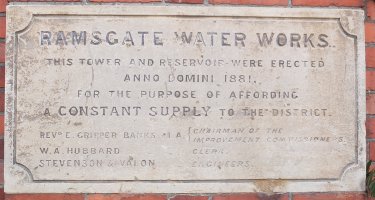
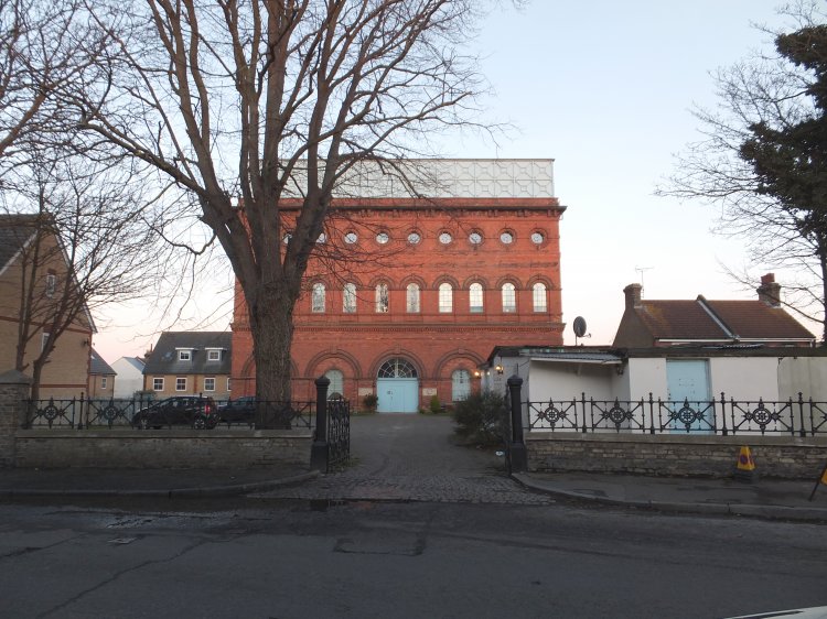
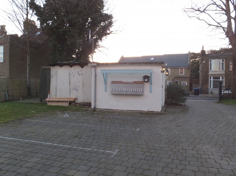
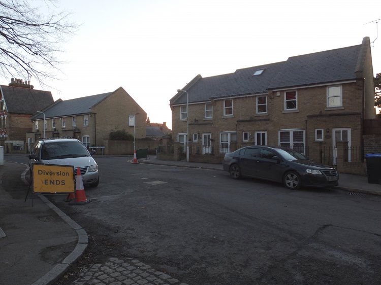
| The former water tower (built 1881, Grade II listed 1988) has been converted to flats. Our interest, however, is in the white building inside the gate on the right hand side... |
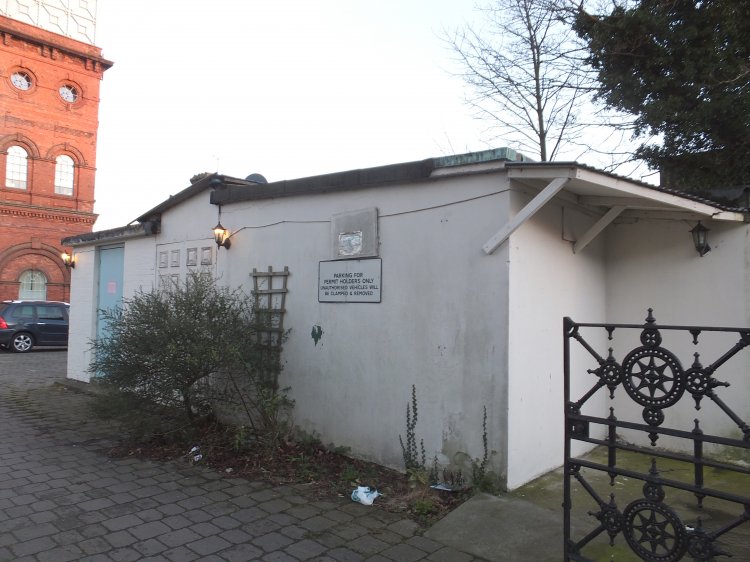
| ...this now appears to be used as stores for the flats, but after mentally peeling away the recent additions there is something familiar about the style and proportion |
| There are, indeed, two buildings. The one to the right of the in-fill is significantly larger and L-shaped, with the walls rendered. The building to the left is of brick construction and essentially square in plan |
| Facing away from the water tower, it's possible to imagine this being the feed point for a T-antenna, with one end attached to the tower. Where would we support the other end? The houses across the road behind the tx buildings occupy the site of other Water Board premises and a covered reservoir |
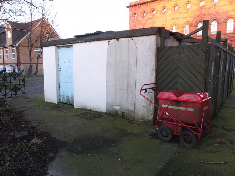
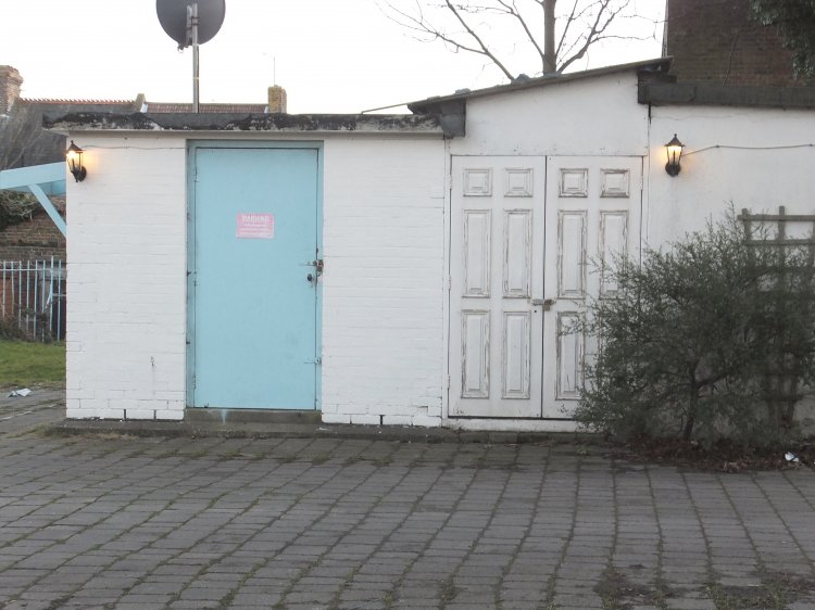
| There is a second doorway behind the plywood panel, and it's possible - see below - this corner was a later addition. The green "extension" on the right is used to store refuse bins... |
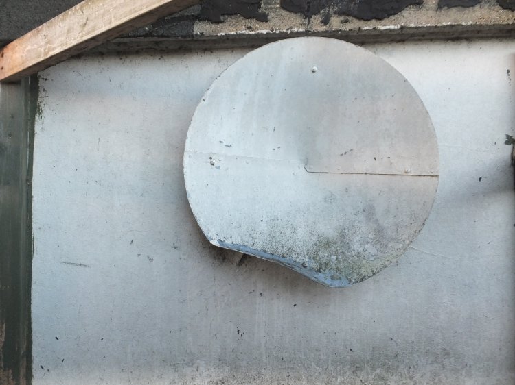
| ...inside which this ventilator outlet is of a familiar style |
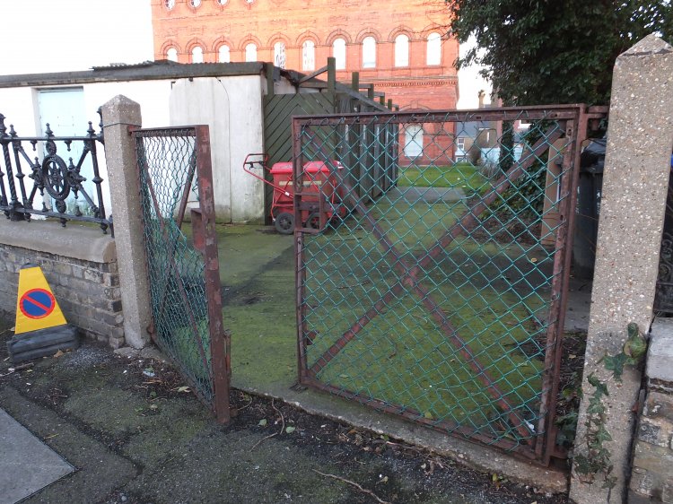
| This gate may be significant - it has clearly been cut into the original boundary wall at some stage. Possibly to provide direct access to a once fenced-off BBC compound? |
| On the opposite side of the road Southwood Heights is a development from around 2001 which occupies the site of "Waterworks House", also known as "The Engineer's House", (90 Southwood Road) and the reservoir behind |
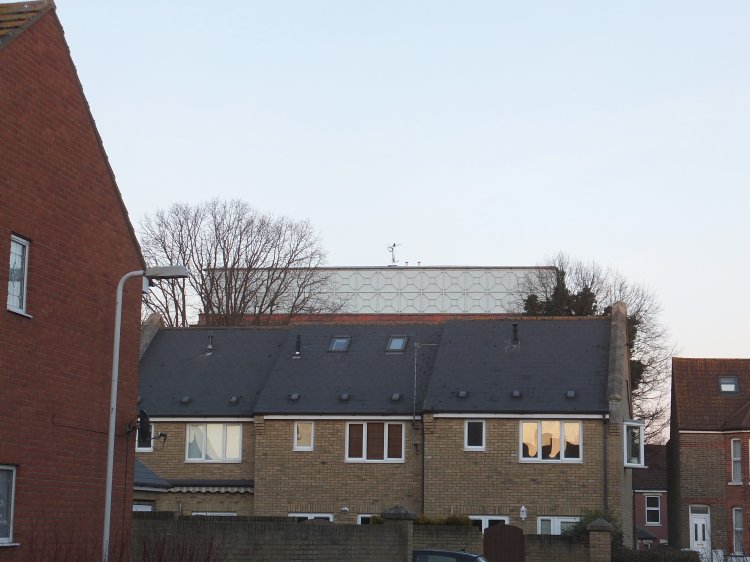
| Looking back from Southwood Heights it seems the 60 ft high water tower would have made a very satisfactory support for an antenna - all we need now is confirmation as to how things were arranged at this end |
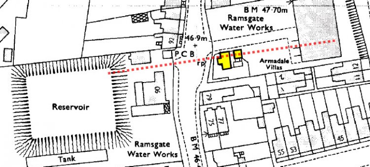
| The above is based on the 1969-1975 OS block plan (original scale 1:1,250) from www.old-maps.co.uk This shows the two buildings highlighted but also what appear to be a couple of small enclosures and an outer enclosure within the main Water Works boundary The 1956 map shows only the larger building - perhaps the second building was required for the 1972 frequency change? The Title Plan for the Water Tower shows two buildings but the T-shape has become an L-shape with the south east corner now filled in A small amount of speculation has been used but the antenna seems likely to have been supported by a mast on top of the reservoir and from the roof of the water tower. The transmitter building - or possibly the small enclosure immediately south of the smaller building - would have been at the base of the T. A comment from Lez Miller in the British Listed Buildings entry for the water tower describes very much this arrangement If we have deduced the details of the installation correctly, Ramsgate MF was unusual - if not unique - in terms of post-war MF sites by being within a residential area and with the antenna running across a public road. The use of an existing non-broadcast structure was also unusual at MF - Lots Road is another notable example |
Folkestone MF | Gillingham MF | Lots Road
Comments page on British Listed Buildings
Ramsgate Water Tower (British Listed Buildings)
Feature: On the Home Front (AM Radio in SE England)
History of Ramsgate Model Engineering Club
| |
Back to TX Gallery index | TX main index
|