 |
UK Broadcast Transmission |
|
|||||||||||
THE TRANSMISSION GALLERY
| Photos by Dan Glover | Page last updated: 2016-02-11 |
|
||||||||||||||||||||||
| A slightly odd site where the tower now used for DAB is otherwise almost completely empty. There is no signage on the main gate but planning documents refer to "Grangewood Police Mast". A pair of (normally similar and square) towers would be a good indicator of a former "Home Office" site. The "west" tower is now inside a second fence which is labelled as Orange The structures here were listed by the Ordnance Survey as "intersected stations" in 1961 with the names "Kirkby Underwood Wireless Transmission Mast East/West" - the "East" entry is noted "destroyed 09/80" which possibly indicates the time when a replacement was built The site was originally expected to be known as "Bourne Callans Lane" but is now known as "Kirkby Underwood" - BBC DAB entered service on 29 January 2016 |
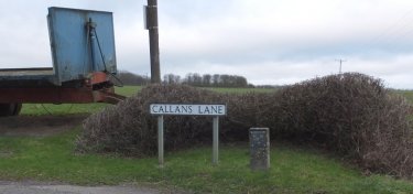
| We're in open country about 4 miles north of Bourne - but Callans Lane is accurate and the site is now known as "Kirkby Underwood" anyway |
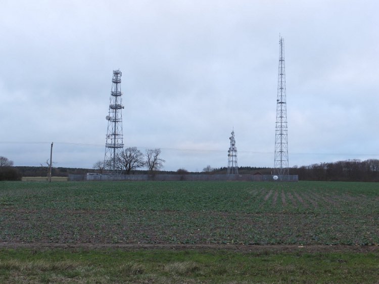
| From the road we see three structures - our direct interest is in the tower on the right... |

| Looking back from the path which runs past the site. This triangular, tapered, tower is 61 m to the top according to the planning application. It seems to be vacant other than the new DAB dipoles, a couple of square SHF panels and a solitary dish |
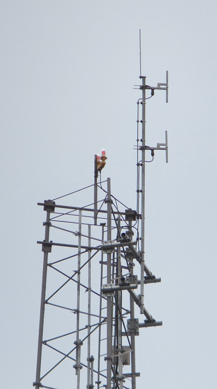
| The dipoles are aligned on bearing 220 - so the intended service area is probably the area between Grantham and Stamford along the A1 |
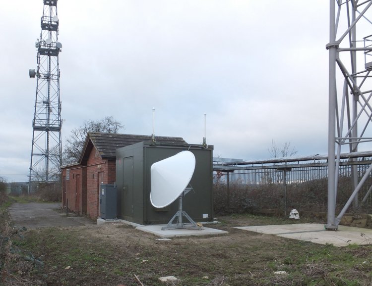
| Peering through the fence we see the expected dish, and a large green enclosure with GPS antennas. The small grey cabinet is for electricity metering The concrete at the base of the tower is also relatively new suggesting it is not the original structure... |

| ...there is a story within the Trigpointing community that this triangulation pillar should be where the new "east" tower now stands. The 1:2500 plan in the planning application however shows a pillar (74.4 m AOD) somewhat east of the compound so I'm not convinced |

| Looking towards the service area - we're on a plateau and the rest of the world is lower down! |

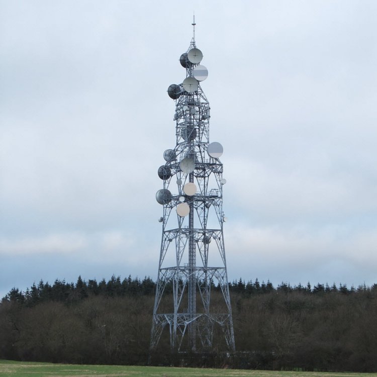
| The BT "Kirkby Underwood" microwave tower is just to the north. We understand this linked Carlton Scroop (north of Grantham) with Morborne (Peterborough) |
| |
Back to TX Gallery index | TX main index
|